Other Greenways
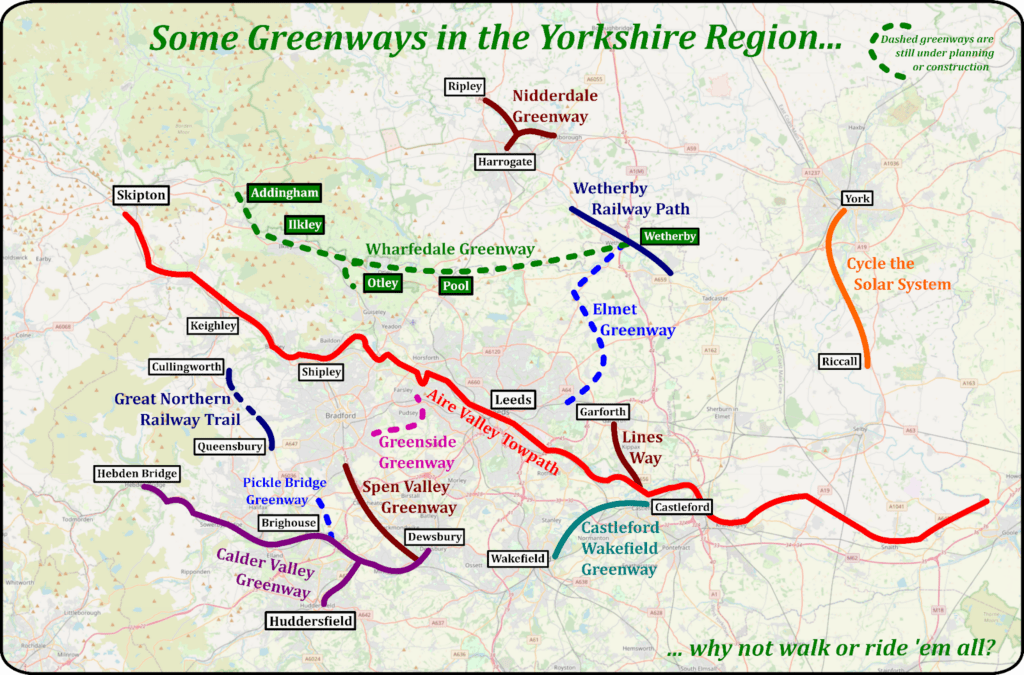
Greenways in the Yorkshire Region
There are many fantastic examples of Greenways and other places in Yorkshire suitable for walking, cycling and in some cases horse riding. Here are some of our favourites – let us know if we’ve missed any!
Aire Valley Towpath
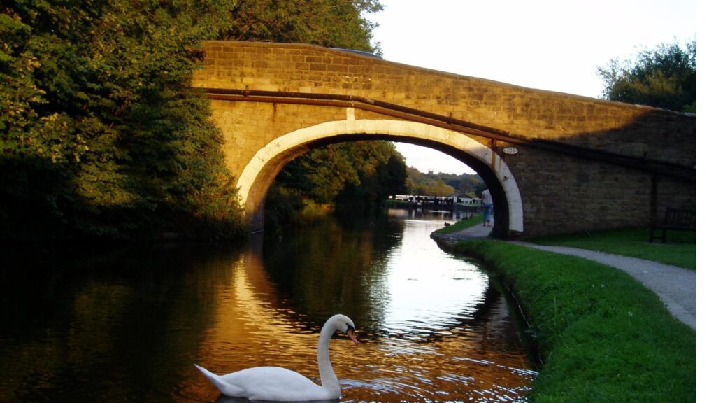
The Aire Valley Towpath route encompasses both vibrant urban areas and beautiful countryside, taking you on a peaceful journey through Leeds and out past Kirkstall Abbey, Bramley Fall, Rodley, Calverley Woods, Apperley Bridge, Buck Wood at Thackley, Shipley, Hirst Wood, Dowley Gap and the Three and Five Rise Locks at Bingley.
You can find out more about the Aire Valley Towpath on the Sustrans website below.
Distance:
16 miles
Type:
Canal towpath. Surface is mostly good with some tarmac.
Calder Valley Greenway
This is a signed, mainly traffic-free route between Huddersfield and Dewsbury town centres. It is ideal for family leisure cycling or to facilitate a cycle journey to work. Much of this route is surprisingly rural passing through a pleasant wooded and agricultural landscape.
Most of the path is built on the former rail corridor of the Midland Railway, with the section from Dewsbury Moor to the town centre on a riverside path. It comprises the Birkby Bradley Greenway National Cycle Network Route 69 and Calder Valley Greenway National Cycle Network Route 66. Some sections of the Calder Valley Greenway are accessible to horse riders.
Distance:
11 miles
Type:
Mainly traffic free
Cycle the Solar System (York)
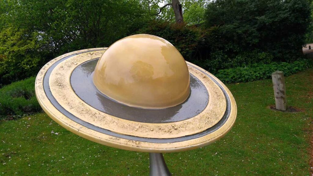
This scale model of the Solar System is spread out along 6.4 miles, which is a ratio of 575,872,239 to 1, which makes the speed of light just 1.16 mph: so just for a while you’re awesomely fast! Along the route you can find scale models of all the planets in our solar system (and Pluto) as well as models of the Cassini and Voyager spacecraft.
Once a railway line, the track is now part nature reserve with great variations of trees and natural wildlife to be encountered. Between Jupiter and Mars you can visit the Brunswick Organic Nursery staffed by folks with learning difficulties who sell refreshments to cyclists. You can see the Cassini probe from the station by Naburn Swing Bridge, but you’ll have to go out beyond the grass maze at Neptune to find the Voyager 1, the first man made object to leave the solar system!
You can find out more about the York Solar System on the University of York website below.
Distance:
7 miles
Type:
Mainly traffic free
Garforth to Woodlesford (The Linesway)
This delightful traffic-free route travels from the small town of Garforth just outside Leeds through lovely countryside, passing a nature reserve and an RSPB site, along a river and canal ending at Woodlesford station.
If you want to extend the route, you could continue onto the fantastic Rothwell Country Park.
You can find out more about the Garforth to Woodlesford (The Linesway) on the Sustrans website below.
Distance:
8 miles
Type:
Traffic free, a mixture of gravel track and tarmacked path.
Great Northern Railway Trail
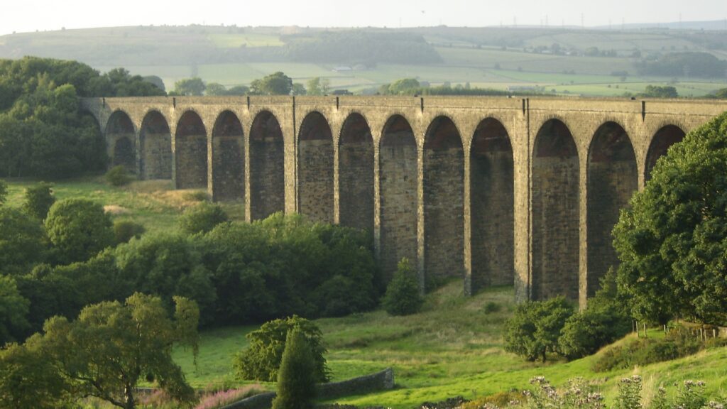
The Great Northern Railway Trail is a beautiful route on the National Cycle Network taking in not one but two spectacular viaducts, making it the perfect day out in this beautiful corner of the Bronte country.
You can find out more about the Great Northern Railway Trail on the Sustrans website below.
Distance:
4 miles
Type:
Mostly traffic free, tarmac path.
Nidderdale Greenway
The former railway line is also known as the Nidderdale Greenway. As well as developing the traffic-free path, this route development included bringing back into use the Grade 2 listed, seven-arch Nidd Gorge Viaduct and providing new safe crossings of the A61 near Ripley. The Greenway also links into the existing cycle network which takes you to Knaresborough, Starbeck and Harrogate.
For the people of Knaresborough, Starbeck and Harrogate the route provides a wonderful gateway to various fantastic National Trust sites to the North. Brimham Rocks, the spectacular Fountains Abbey and Studley Park are all within a 15 mile cycle ride.
You can find out more about the Nidderdale Greenway on the Sustrans website below.
Distance:
4 miles
Type:
Traffic free path.
Spen Valley Greenway
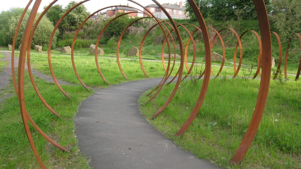
The route is a wonderful green corridor running through densely populated urban areas with long distance moor-land views, it passes a wildlife reserve and a rolling golf course.
The path is also home to a collection of artworks including Sally Matthew’s flock of Swaledale Sheep, constructed from recycled industrial scrap, and ‘Rotate’ by Trudi Entwistle – 40 giant steel hoops set in a circle.
The route is traffic-free with a gentle climb from Dewsbury to Oakenshaw. From Oakenshaw, you can continue into Bradford using signposted cycle lanes and paths.
You can find out more about the Spen Valley Greenway on the Sustrans website below.
Distance:
7 miles
Type:
Traffic free path.
Wetherby Railway Path
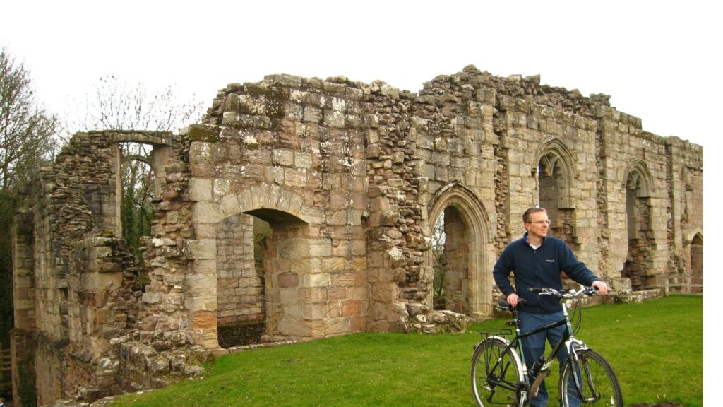
The route starts at Spofforth Castle in Spofforth, which is the picturesque ruin of a once fortified 14th century manor house belonging to the powerful Percy family. Entry to the castle is free and well worth a visit. The route continues along a traffic free route through Spofforth and takes you onto the historic market town of Wetherby, which sits on the banks of the River Wharfe. Equidistant from London and Edinburgh, it became an important staging post for mail coaches in the 18th century. Make sure you explore the Town Hall, the Parish Church, the river bridge and The Shambles. The route takes you out of the town and past Wetherby Racecourse. From here the route continues onto Thorp Arch.
You can find out more about the Spen Valley Greenway on the Sustrans website below.
Distance:
6 miles
Type:
Mostly traffic free.
Greenside Greenway
The Greenside Greenway will be a high quality walking, cycling, and equestrian route linking Pudsey with Tyersal.
You can find out more about the Greenside Greenway on the website below.
Distance:
6 miles
Type:
Mostly traffic free.
Elmet Greenway
Elmet Greenway is a proposed route for pedestrians, cyclists and horse riders. It will follow the former railway line from Cross Gates rail station and shopping centre via John Smeaton Centre and Scholes to Thorner and eventually, we hope, to Wetherby.
The project is a Leeds City Council initiative, but is supported by Elmet Greenway Group which has recently obtained charitable status.
At present Sustrans, the charity which promotes cycling and walking as a means of transport, is updating a feasibility study first carried out in 2008, which is expected to be completed in autumn this year. Following this there will be a public consultation.
You can find out more about the Elmet Greenway on the website below.
Distance:
tbc
Type:
tbc
Castleford/Wakefield Greenway
The next phase of the Castleford Greenway will be a 1.3 km stretch of traffic free route and will link the existing National Cycle Network route 67 with Methley Junction. The new stretch of route will be a 3 m wide shared use path for people travelling by bike or on foot.
You can find out more about the Castleford/Wakefield Greenway on the website below.
Distance:
9.9 miles
Type:
Mostly traffic free.